-
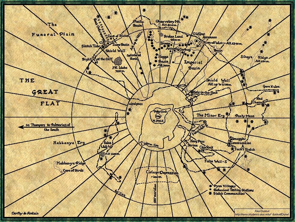
Carthag: about 200 km. northeast of Arrakeen.
-
Cave of Birds: in Habbanya Ridge.
-
Funeral Plain: open erg.
-
Great Bled: open, flat desert, as opposed to the erg-dune area. Open desert runs from about 60� north to about 70� south. It is mostly sand and rock, with occasional outcroppings of basement complex.
-
Great Flat: an open depression of rock blending into erg. It lies about 100 m. above the Bled. Somewhere in the Flat is the salt pan which Pardot Kynes (father of Liet-Kynes) discovered. There are rock outcroppings rising to 200 m. from Sietch Tabr south to the indicated sietch communities.
-
Harg Pass: the Shrine of Leto's skull overlooks this pass.
-
Old Gap: a crevasse in the Arrakeen Shield Wall down to 2240 m.; blasted out by Paul Muad'Dib.
-
Palmaries of the South: do not appear on this map. They lie at about 40� south latitude.
-
Red Chasm: 1582 m. below Bled level.
-
Rimwall West: a high scarp (4600 m.) rising out of the Arrakeen Shield Wall.
-
Wind Pass: cliff-walled, this opens into the sink villages.
-
Wormline: indicating farthest north points where worms have been recorded. (Moisture, not cold, is determining factor.)
|